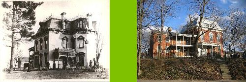
If you have ever wondered about the history of your house then you should investigate the Sanborn Fire Insurance maps. These maps were initiated in 1887 and were updated every so often. Many major cities were mapped and the maps are very detailed. Our house first appears on these maps in 1932 and again in 1950. You can see a plan of it below.

The dots and crosses are codes for the type of roofing material used and they give you the height of your building in stories. Many of these maps are accessible online through library networks or university research databases. I have only accessed Ohio records so I am not sure what is available in other states. You should check them out. They will give you a great insight to the development of your neighborhood. If you do a keyword search you will find a good deal of information out about them but it may be a little harder to access your particular map and it may warrant a trip to your library or university library.
1 comment:
Thanks for the tip - I Googled for Sanborn maps and found a zoomable/downloadable map for our town here:
http://sanborn.umi.com/
Post a Comment